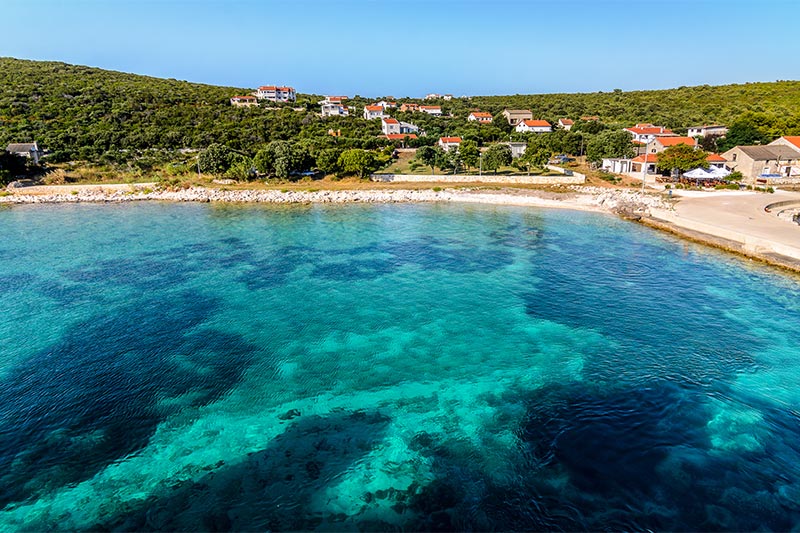
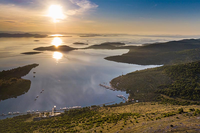
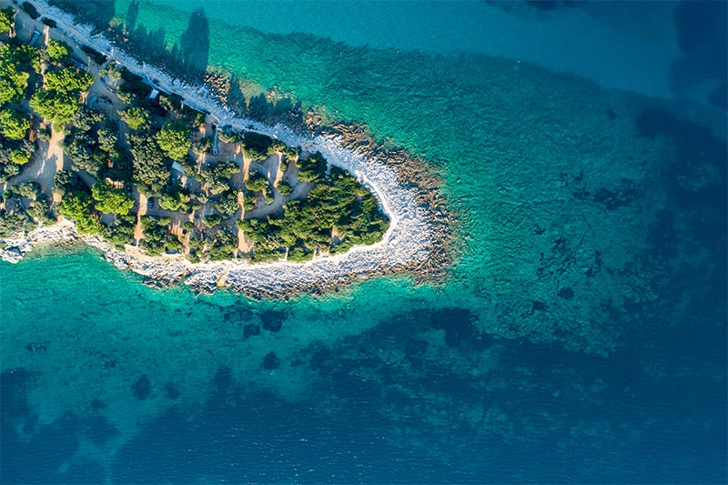
DAY 1: UNIJE 22NM
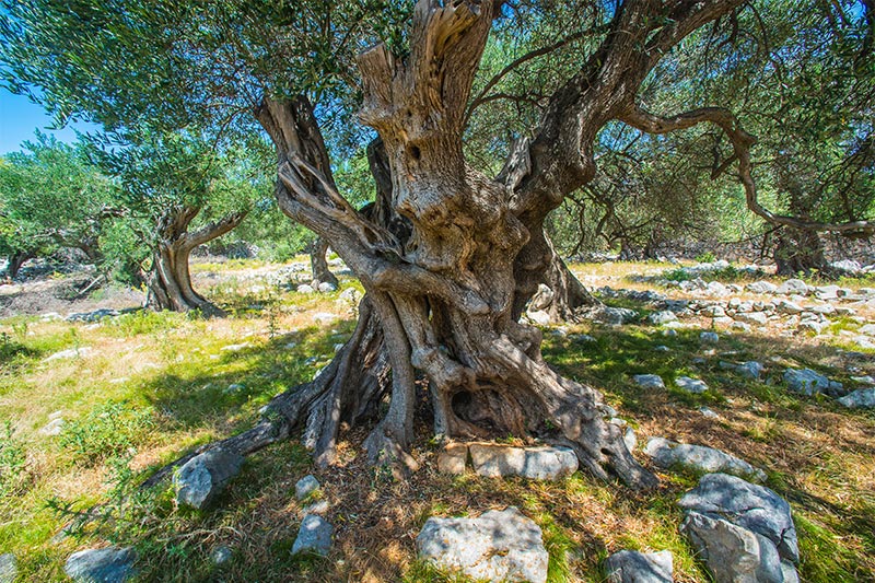
Unije, the largest of the islands surrounding Lošinj, was populated through all historical periods due to good geographical and traffic position at the entrance of Kvarner, several sources of fresh water and broad fertile land.
Both the northern and eastern sides of the island are steep and rocky, overgrown with evergreen holly-oak, while the southern and western sides are more unbroken and form a bay where only here one can see mirrored in the sea the facade of its houses and fertile fields. This is an island of olive groves whose
branches bear witness to their distant past. The highest point of the island is Kalk (132 m.).
It is suggested that those arriving on the island with their own boat should use the more accessible western side of the island, in the bay of Maračol, where the sea is deepest.
There are no cars on the island.
In the village there are several restaurants, patisseries, bakeries, a post office and grocery stores. A regular shipping line connects the island with Lošinj and several times a week the island is linked by catamaran with Rijeka.
DAY 2: MALI LOŠINJ 12NM
Mali Lošinj is the biggest settlement on the island, found on the southern side of the Bay of Lošinj, which thanks to this position has become a very important maritime and commercial centre, and today, also an important tourist destination.
Positioned in the August Bay, the biggest closed bay of the island, and with 7000 inhabitants, today it is the biggest island town in the Adriatic.
Today Mali Lošinj is one of the main tourist centres on the Adriatic known in all European tourism circles, which is proofed by an ever bigger number of guest that visit the island every year.
Mali Lošinj was the recipient of the title „Champion of Tourism 2007“, and for 2009, Mali Lošinj is the Croatian candidate for the Golden Flower of Europe 2009.
DAY 3: PREMUDA 15NM
Premuda is a little island and it belongs to the north Dalmatian islands which are situated north-west from the county center Zadar. Premuda is approximately 10 km long, up to 1 km wide, and has an area of 9.2 km2. It is situated southwest of Silba and northwest of Škarda .
The town of Premuda has about 50 inhabitants but the population strongly varies during the summer season. The population of Premuda is cultivating olives and breeding sheep and in the last few years they have become involved with the tourism.
Premuda is a popular destination among nautical and diving tourists. Premuda has some very popular diving spots. The "Katedrala" is a system of connected caves with beautiful light rays that fall through the porous ceiling of the caves. An also famous diving spot is the wreck of the World War I Austro-Hungarian
battleship SMS Szent István, which is located in a depth between 40–60 meters (131–199 feet) and accessible only by experienced divers.
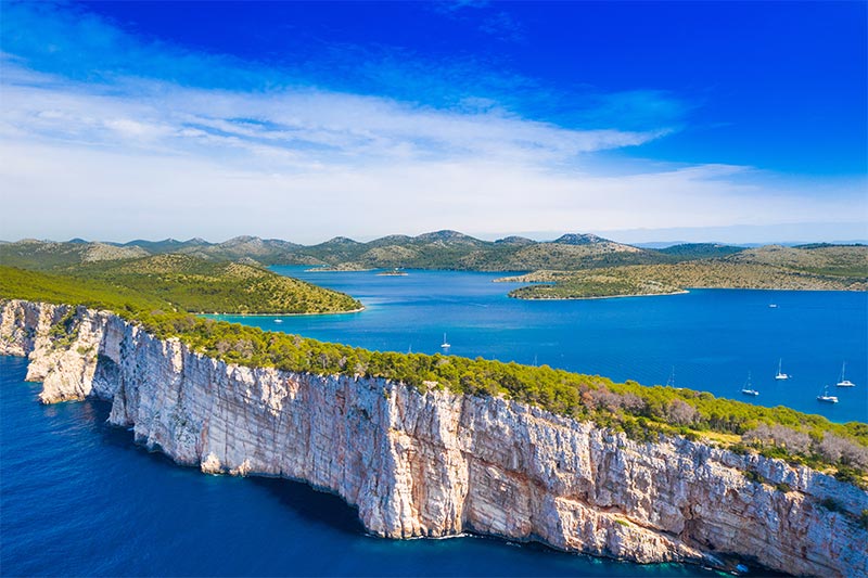
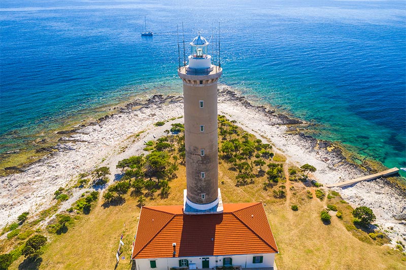
DAY 4: DUGI OTOK - VELI RAT – SAHARUN 17NM
Dugi Otok is the biggest island of Zadar's archipelago, 50km long and about 5km wide. It is quite distant from the coast - one hour and a half by ferry from Zadar and it remains one of those few places where you can enjoy tranquillity even in high season, ideal for tourists that will appreciate the peace and the
natural beauties.
Island Dugi Otok beaches are different from one area to another. In the area of village Sali, the largest village on the island, there are mainly rocky beaches with stone terraces and cliffs and pinewoods. In the northern part of the island there are some sandy beaches accessible only with boats and the beautiful
beach Saharun reachable by car as well. Nearby is the Pantera bay with sandy beaches.
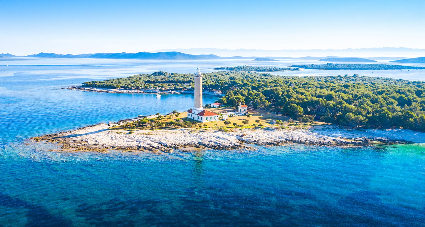
Saharun or Sakarun sandy beach is situated on the wooden northwest coast of Dugi Otok, south of Soline and near Bozava and Veli Rat. It can be easily reached by car.
The Saharun beach is a long beach facing the open Adriatic sea. It is a beautiful cove of white sand, which gives the water turquoise color, and surrounded by pine woods. Even 200 m far from the coast, the sea is shallow only up to your waist. Drinks and sandwiches are available from the small snack bar.
Saharun is becoming known for its summer beach parties which last 24 hours.
One of the attractions is a 41-metre-tall lighthouse in the vicinity of Saharun, at Veli Rat. Island has other beautiful sandy beaches accessible only with boats. Waters in this area are rich in fish, while the well-indented coastline is perfect for boaters and water sports enthusiasts. Naturism is practiced almost everywhere except the beaches near by villages.
SLEEPING IN MOLAT: 6NM
The Molat island is situated in the northern part of Zadar's archipelago. It is connected to the coast (Zadar) with daily (only one) line by ferry and this is usually the biggest problem to organize the holiday on Molat. The peace, silence and necessary minimum of infrastructures (4 restaurants, 3 shops) guarantees an holiday far away from usual tourism.
There are 3 places on Molat: Molat, Brgulje and Zapuntel connected with an road. It is recommended to bring an boat, even little, and cruise around island discovering quiet bays and beaches.
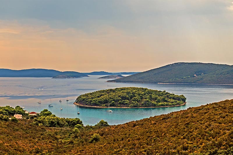
DAY 5: ISLAND OF SESTRUNJ
Sestrunj is situated in the mid Adriatic and belongs to the group of smaller islands of the Zadar archipelago.
The island and the settlement of the same name in the Zadar archipelago are partially covered with maquis and low vegetation. It is particularly attractive for yachtsmen due to its location on a natural navigational route from Zadar to the westward islands. As a result of its position in the middle of the archipelago and its high altitude, it gives an exceptional view over a great part of the Zadar archipelago and shores.
SLEEPING : Island of Zverinac
Zverinac is situated west of Zadar and is very well connected with ferries and catamarans operating on a daily basis during summer. This petite village of fishermen is a home for a small number of families who live there throughout the year. They are very proud of their oil mill, one of the oldest on the Adriatic, which still uses the traditional way of oil production. The May 2005 issue of National Geographic Croatia published a story of this mill. The beaches are mostly natural, rocky, intimate, and located in several bays. A coastal road leads to every beach. There are also a few pebble beaches, but they are somewhat rare. On some beaches there are special structures built for gradual descent to the sea.
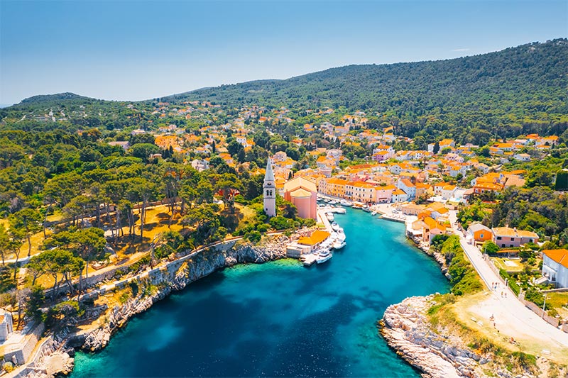
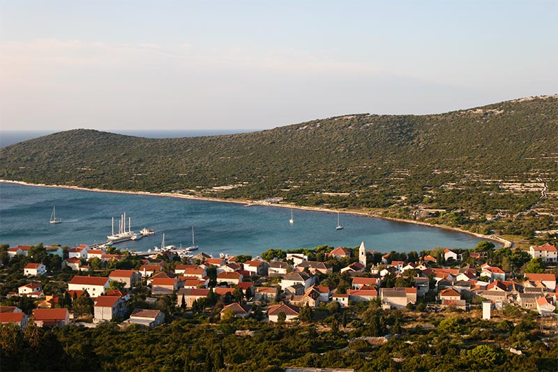
DAY 6: DUGI OTOK - SALI
It is located on the north-eastern coast of the island and has a very well established excursion, nautical and sports tourism. In Sali guests have a medical and dental clinic, a post office, an ATM, a Harbour branch office and an arranged mooring for ships at their service. Sali is a place of a thousand-years-old fishing tradition, which was confirmed by written documents from the 10th century and ancient olive groves surrounding the village witness the intensive agricultural activities throughout the centuries.
The cultural heritage of Sali is represented by sacred buildings such as the parish church of the Assumption of the Blessed Virgin Mary with a gorgeous wooden altar from the 17th century and inscriptions written in Glagolitic, as well as the churches of St. Roch and St. Nicholas. There are also remains of layouts of other Christian churches in the fields of Sali.
One of the most interesting events is the Sali Festival called Saljske užance, a three-day festival with the famous Tovareća mužika (donkey music) performing at the festival.
With its tourist facilities, the vicinity of the Nature Park Telašćica and the National Park Kornati, Sali is an ideal place to relax. All those fans of active vacation can rent a boat, a bicycle or a scooter in Sali and experience the beauty of the place and the whole island. There is a taxi service that offers a driving tour around the island for those who are interested.
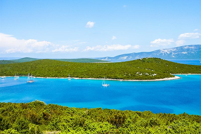
DAY 7: ŽUT
Žut is one of the islands of the Kornati archipelago. It is located between the island of Pašman on the one side, which is connected to the mainland by a boat heading to Ugljan, and the island of Kornat on the other. With the surface of almost 15 km2, this oblong island is only 2 km wide and its highest peak is 172 m high. The inlets of Hiljača, Sarušćica, Bizikovica, Golubovac, Žešnja, Podražanj, Strunac and others line up along its steep and very indented coastline, providing Robinsonian atmosphere and possible shelter for small fisherman boats and small sailboats.
There are no permanent settlements on this island covered with olives, figs and vine, but over the year various fishermen and shepherds, olive producers and fig pickers from the island of Murter occasionally stay here. Since Kornati are a nautical heaven, there is also a marina with around 120 berths on Žut.
Therefore, this place is ideal for everyone coming to their summer vacation with their own or rented boat, since the sea around Žut, as well as the entire Kornati archipelago, is the best spot for water sports.
THE PORTS ON ŽUT
The ports on Žut are located in sheltered coves.
Pod Ražanj. This is the name of the largest cove on Žut, located between the peninsulas, Ražanj in the west and the Strunac in the east. The best-known Murter olive groves are located on the slopes of the cove, at the foot of Grba, Travanj and Gubavac, and the oil from these slopes is regarded as the finest. A modern yacht harbour with about a hundred mooring places and the necessary services has recently been built in the western part of the cove.
Bizikovica i Pinizel. Sailing further towards the northwest along the Ražanj peninsula, we come to the cove Bizikovica. At the very bottom of the cove are the houses and olive groves of many families from Murter. An impressive view of the archipelago of Žut and Sita opens from the near-by peaks Tvrdomešnjak, Travanj and Gubavac.
SAILING IN
Coming from the West (from the direction of NP Kornati), the shortest way to Žut is through the passage of Proversa vela or Proversa mala. By night it is recommended to sail through the passage of Proversa mala, which is well marked with sea lights. Looking from the direction of Zadar, there is the passage of
Mali Ždrelac (12.5 m high bridge). On the entrance to the inlet of Žut, where the ACI marina Žut is situated, the island of Maslinjak is located. The exact position of the northern cape of the island of Maslinjak, which is 43°53.2’ N 15°18.8’ E, may serve for navigation purposes.
DAY 8: ZADAR
A city of exceptional 3000-years old history and extremely valuable cultural heritage, Zadar will always offer something new and original.
The city of Zadar is situated in the heart of the Adriatic, and it is not just an urban centre of northern Dalmatia but with its administrative, economic, cultural and political importance it constitutes the centre of the region with 92.000 inhabitants. Combining the beauties of the past and preferences of modern-day tourism, it offers numerous tourist attractions: if you are looking for an ideal accommodation, autochthon gourmet delicacies, cultural monuments, modern-day sports facilities or various excursion programs, you have found a perfect destination for leisure, sports and fun.
DAY 9: ISLAND OF IST
The aquatorium around Ist is abundant with fish and thus a magnet for sports fishermen; divers are also well-acquainted with its submarine richness. There are anchorages in Ist and Mljake bay. The peaceful island of Ist and its main settlement of the same name placed in a bay with a small marina are ideal for those who prefer quiet, somewhat secluded outdoor holidays. The island has barely 250 inhabitants. There are hills, olive groves and vineyeards in its interior. Ist and the neighboring islands of Molat and Skarada, with their sandy beaches, bays and sandbanks are ideal for sports fishing, diving and nautical tourism.
DAY 10: OLIB – SLATINICA BAY
Olib is an island in northern Dalmatia, located northwest of Zadar, southwest of Pag, southeast of Lošinj and just east of Silba with an area of 26.14 km2. The products of Olib include wine, olive oil, and cheese. Olib has no native freshwater sources. Consequently, nearly all homes on the island are built with cisterns to capture rainwater. There are also two communal wells available to residents.
SLATINICA is a beautiful bay on the eastern side of Olib. From June until the end of September, there are buoys for mooring. There are 13 buoys in all. The price of mooring to a buoy is 1.36 euros (10 kuna) per metre. As the bay is spacious, there is plenty of space for anchoring. Anchoring costs 0.68 euros (5 kuna) per metre. The bottom holds anchors well. Slatinica offers good shelter from summer storms, which are frequent in this area. When the jugo and bura winds blow it is not safe. You should anchor at a distance of around 100 metres from the shore, because shallow water extends far from the coast. You can reach Olib from Slatinica beach by following a path through the woods. It is roughly a 20-minute walk.
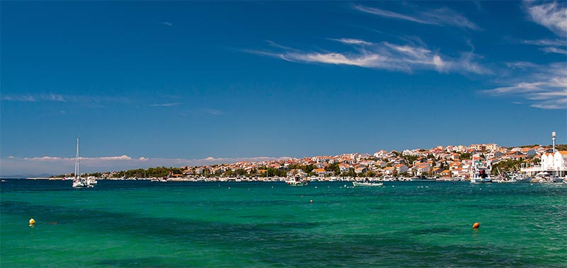
SLEEPING IN NOVALJA:
Novalja is at the moment one of the most desirable destination for summer vacations on the Adriatic. Tourists of all generations are offered sport and cultural facilities, numerous parties, great gastronomic offer, and it is especially mportant to point out the large number of wonderful beaches in the immediate proximity of the town.
DAY 11: SPENDING THE DAY IN THE BAYS BETWEEN NOVALJA AND LUN (ISLAND OF PAG)
Lun on the island of Pag : Lun is a village on the northernmost tip of the island. One of the world's three sites with a large number of wild olive trees, or in Latin Olea Oleaster. We invite you to use this opportunity to get to know his eternal olive trees, blue sea, people and biblical landscape.
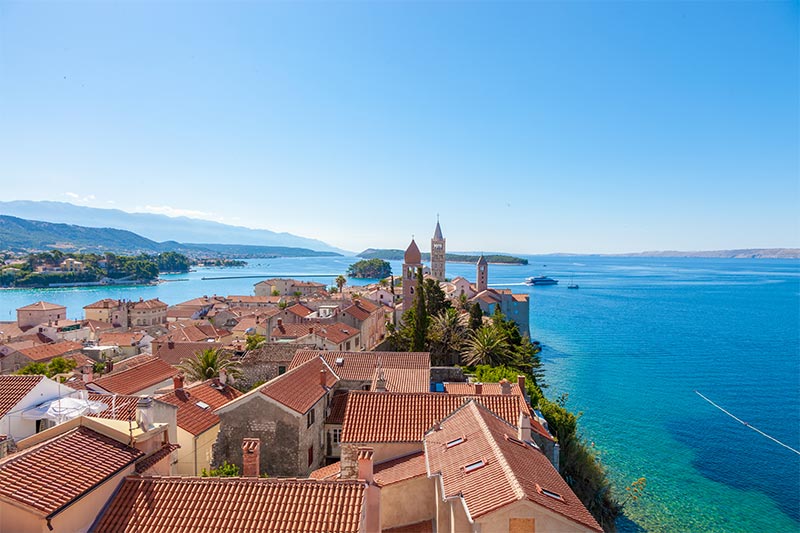
SLEEPING IN RAB:
The town of Rab is a typical medieveal township with wide and generally well conserved forticative walls. The four prominent bell towers not only form the central landmark in the town’s landscape, but also act as the main characteristic by which the town of Rab is recognised. Saint Christofor town square, paved with large white stone, awaits the visitor at the very entry point to the old town of Rab. Here one can find a water fountain portraying Kalifront and a beautiful shepheard girl Draga, characters from a Rab legend.
From here one arrives at the town park Kmrcar, whichi is traversed with inviting romantic pathways. One can rest on park benches shaded by century old cone trees, oaks, agavas and many other trees. Stone steps descend to the seas and town beach in the Bay of Saint Euphemius.
DAY 12: ISLAND OF KRK – PUNAT
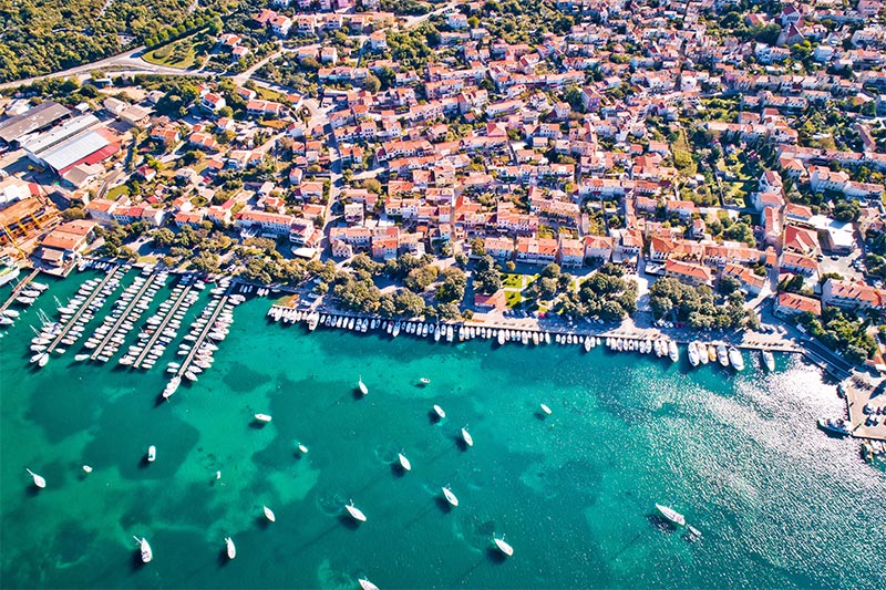
Punat, located on the east coast of the more than 3 km long and 2 km wide Punat valley, is considered one of Krk’s more recent villages. However, this belief is connected to the fact that studies and more detailed reports regarding this area only began around a hundred years ago. Earlier it was part of the city of Krk, and the area of Vrbnik almost reached the village of Punat.
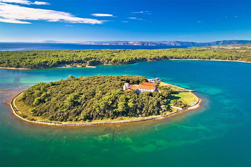
Today Punat is one of the largest nautical centres in Croatia, and it is also the island's olive-growing centre. To talk about Punat, and not to mention the small island of Košljun, is unimaginable. Punat and Košljun have being connected for centuries, the lives of the Franciscan friars and the people from Punat are mutually intertwined. So every visitor is sure to want to visit the island of Košljun which is served by “barkajoli” that continuously travel the 10 minutes journey from Punat to Košljun and back again. Although the distance from Punat is only 750 meters and it has been connected to it for centuries, the island of Košljun belongs to the city of Krk according to the cadastral map.
The size of the small island with its rich vegetation is slightly larger than a thousand meters, its surface is 68 square metres, and its highest point is located 6 metres above sea level. On this relatively small surface 540 plant and mushroom species (almost half of those registered in whole of Great Britain) are registered here. The Franciscan Monastery is located on the island of Košljun where the friars, over the centuries, have conserved a number of values.
SLEEP IN CITY OF KRK
Krk appears elegant and harmonious when you approach it from the sea. Its historical nucleus is the widest on the southern part and extends by the sea. Becoming more and more narrow, the town is settling up to the north, creating the town nest inside the walls. All the roofs are standing in the perfect balance, except four bell towers which are projecting straight to the sky. Among them, there is the dominant cathedral bell tower which is also guard and messenger, a sonorous lantern.
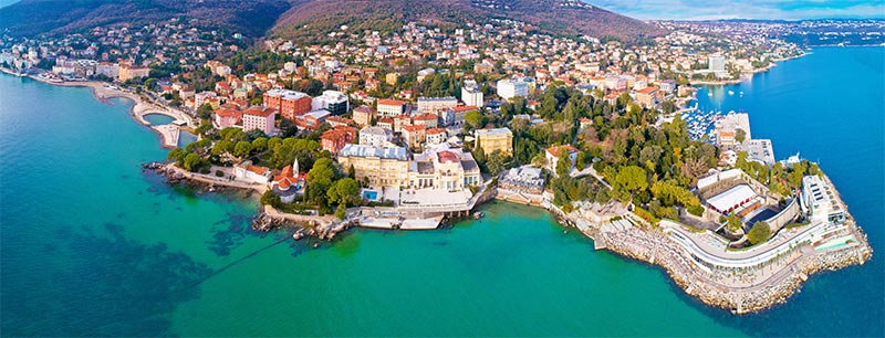
DAY 13: CRES
With an area of 405.78 km², Cres is the same size as the neighbouring island of Krk, although Krk has for many years been thought the largest of the islands. Cres has a population of 3,184 (2001). Cres and the neighbouring island of Lošinj once used to be one island, but were divided by a channel and connected with a bridge at the town of Osor. Cres's only fresh water source is the Lake Vrana.
TOWN OF CRES:
The town of Cres is situated in the northeastern part of a large and well shielded bay which abounds in spacious and attractive bathing areas. The human activity, dating back to the Antique period, has left a whole range of monuments which help us to imagine how difficult life must have been on this island. The streets of Cres are notably narrow, similar to Italian cities, and are conducive to walking and mostly free of car traffic. The city contains various shops where visitors can purchase the local-made wine and olive oil which the city is known to produce. The downtown area is very lively with a variety of locally-crafted goods being sold on the street as well as in the many shops . There are also several restaurants , almost all open-aired where visitors can sit and enjoy delicious local cuisine, while watching boats move in and out of the bay.
The Marina located on the outskirts of Cres has recently been awarded the prestigious blue flag award given to a very select group of outstanding beaches and marinas to distinguish them as among the best in the world. The marina is separated from the docks near the center of town and is used to house boats owned by many of the island’s natives as well as serving as a dry dock for repairing large ships used in the thriving Adriatic sea fishing industry.
DAY 14: Cape Kamenjak and the Medulin Islands
Kamenjak is the most southern end of Istrian peninsula located near Medulin popular tourist resort, and Banjole and Premantura villages. Kamenjak is long, narrow peninsula, about 9.5 km long and as wide as 1.5 km. It has been proclaimed as nature park and it is under special protection.
The entire coastline of the cape is 30 km long dotted with numerous inlets, coves miniature beaches and small islands. There are many dirt roads and paths all over the peninsula leading to the most hidden areas.
Kamenjak is especially attractive for diving enthusiasts because of its fascinating underwater world. Waters around Kamenjak are especially rich with fish which makes it a wonderful place for sport fishing, especially in Albanez cove, near far south end of the peninsula. Lots of people come over here for sunbathing and swimming during the summer. Rocky beaches absolutely untouched with cliffs vertically on the sea in one side and pebbles on the other side. Clear clean water and quiet coves attract all those seeking for some peace and privacy, loneliness and skinny dipping.
There are some pebbly beaches suitable for children, but mostly it is rocky coastline with flat rocks which are so inviting for sunning and daydreaming. In southern parts of the cape swimmers have to be careful because of strong sea currents, which can drive away careless swimmers far from the coast. Caution is especially needed during high/low tide change.
At the southwest end of the cape, there is an interesting Safari Bar, Robinson style place, offering refreshments and snacks. Children will especially enjoy it here because of interesting and unusual installations. Adventure guaranteed.